Brooks Range, Alaska · 68.13°N, 149.48°W · 4,739 ft
The pipeline you can't see
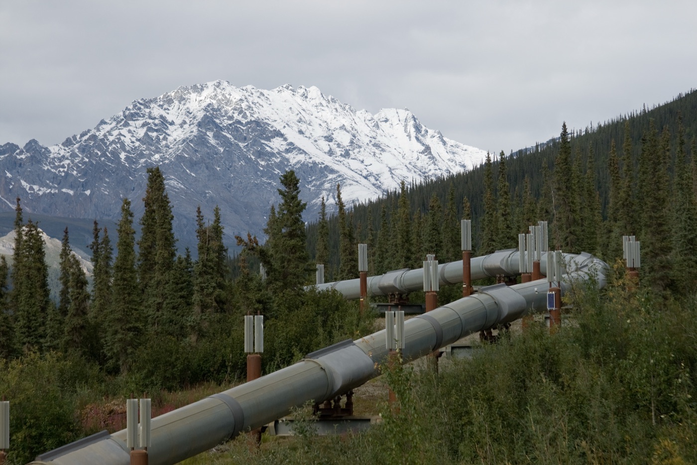
For roughly 6,000 feet through Atigun Pass, the 48-inch Trans-Alaska Pipeline runs underground inside an insulated, reinforced-concrete box. Roughly half of the 800-mile line runs above ground on supports so operators can watch it move. Here, avalanches ruled that out: the pass carries 40 or more avalanche paths, so burial was the safer choice even though it hides the pipe from view.
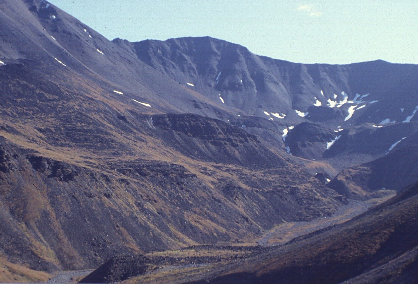
What does the pass look like right now?
The same roadside camera Alaska DOT&PF uses to watch the Dalton Highway, and live wind over the pass. Conditions here flip fast: this is the terrain every sensor on this page is trying to keep ahead of.
Live: Dalton Highway at Atigun Pass (Alaska DOT&PF 511), refreshed every 30 seconds.
Live wind over the pass (Windy).
Why bury a pipeline through a mountain pass?
In January 1993 an avalanche buried more than 600 meters of the Dalton Highway at the pass. Alaska DOT&PF runs a standing avalanche-control program here, firing artillery to trigger slides before they run on their own schedule, and is now piloting Doppler radar detection. No public avalanche forecast exists for Atigun Pass: DOT&PF closures posted at 511.alaska.gov are the only public signal, not a danger rating.
- Snow
- Stream gauge
- Seismic
- GNSS
- Ground-temperature borehole
- -5.5 °C and colder
- -5.5 to -5.0 °C
- -5.0 to -4.5 °C
- -4.5 to -4.0 °C
- warmer than -4.0 °C
Markers show the monitoring stations referenced on this page. The solid line is the Dalton Highway (© OpenStreetMap contributors); the pipeline parallels the road through the pass, and the surveyed centerline is not public. The colored grid is mean annual ground temperature at the top of permafrost from the Beadedcloud permafrost API (fused Pastick 2015 + Obu 2019), sampled at the datasets' native resolution.
What could move the ground under the pipe?
How much snow is sitting above the pipe right now?
SNOTEL Atigun Pass #957 sits at the summit and has measured snow depth and precipitation there since 1981. This chart pulls the live station record for the last 90 days.
Source: NRCS Air and Water Database, SNOTEL station 957:AK:SNTL.
What happens when it melts?
The Atigun River crosses the corridor just north of the pass, and it has already forced one major reroute. Corrosion found by a 1988 inline inspection led Alyeska to replace 8.5 miles of 48-inch pipe through the floodplain in 1990 and 1991, burying it at least 5 feet below the river thalweg and armoring the banks with gabion mats and articulated concrete matting sized to a design flood of 3,042 to 13,640 cubic feet per second.
Source: USGS NWIS instantaneous values, streamgage 15905100 (Atigun River below Galbraith Lake). Reroute details: Oil & Gas Journal and Alyeska Pipeline project history.
How often does the ground shake?
TAPS has run its own earthquake-monitoring program since 1977. Accelerographs at pump stations feed a system that, together with USGS ShakeMap and ShakeCast, helps prioritize post-earthquake inspections along the whole line.
Source: USGS FDSN earthquake catalog, bounding box around Atigun Pass, since 2020.
Is the permafrost holding?
A pipeline carrying warm crude oil sits inside frozen ground here, and frozen ground does not stay put under a heat source. Thaw settlement and frost heave pull in opposite directions, but both can strain a buried pipe: in one documented case, about 0.2 meters of frost heave over a 22 to 25 meter span was enough to cause upheaval buckling. Boreholes at Chandalar Shelf and Galbraith Lake bracket the pass and have measured ground temperatures since 1985, the kind of record thermistor strings extend into a continuous active-layer picture.
No published automated thaw-alarm system exists on TAPS today. Detection is inspection-based: engineers read borehole and inline-inspection records after the fact, not a live alarm before the fact. Continuous ground-temperature monitoring, tied to a threshold alarm, is the missing layer, and it is the problem Beadedcloud is built to solve.
Is the slope creeping?
Satellite radar already covers this exact coordinate. 809 Sentinel-1 SLC scenes have been collected here as of mid-2026, and NASA's OPERA DISP-S1 product (frame F34987) already processes displacement from that archive, with a GNSS station at Toolik Field Station nearby for ground truth. Inverse-velocity forecasting, which extrapolates accelerating displacement to a predicted failure time, works honestly only once a slope has already entered accelerating creep, and its thresholds have to be calibrated per site: there is no universal warning speed.
This is a coverage summary, not a displacement time series: publishing a fabricated displacement chart for a slope with no released measurement record would misrepresent what is actually known.
How do you watch all of it at once?
No single sensor catches every hazard at Atigun Pass. Real monitoring stacks three tiers, each catching a different kind of precursor, and the strongest programs alarm on the rate of change in a signal, not just its absolute value.
- InSAR (Sentinel-1, OPERA DISP-S1): Months-to-years slope creep across the whole corridor
- Optical change detection: Surface disturbance, new scarps, vegetation loss
- Weather: Rain-on-snow and rainfall-intensity triggers
- Snow pillow (SNOTEL): Antecedent snowpack ahead of a melt or rain-on-snow event
- Stream gauges: Rising discharge ahead of flood-driven scour
- Seismic accelerographs: Ground shaking severity for post-event inspection triage
- GNSS monuments: Absolute 3D ground displacement at known hazard points
- Piezometers: Rising pore pressure, the earliest hydrologic warning of slope failure
- Tiltmeters and ShapeArrays: A kink at depth marking a forming shear plane before it reaches the surface
- Total station and prisms: Sub-millimeter surface displacement at a known slide
- Thermistor strings: Active-layer thickening and deep ground-temperature trend
- Soil moisture and rain gauges: Volumetric water content rising ahead of pore pressure
- Infrasound arrays: Avalanche or slushflow events in progress
- Fiber DAS / DSS / DTS: Strain, vibration, or temperature anomalies along the pipe wall
- Vibrating-wire strain gauges: Bending strain building at a known crossing
- IMU pig runs: Sub-critical bending strain months before a rupture, per one documented case
Want this view on your corridor?
Beadedcloud builds site-specific insight pages, permafrost-API access, and sensor-driven monitoring for Arctic operators. Early access is open.
Sign up for Beadedcloud